Retail property · REIT · Digital Product · Visuals
Spatial Map Design for In-Mall Web App Digital Way Finding
Helping customers navigating to their desired destination.
Overview
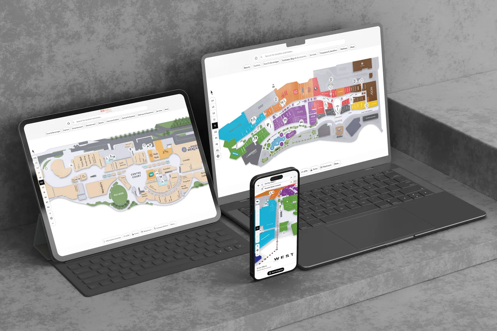
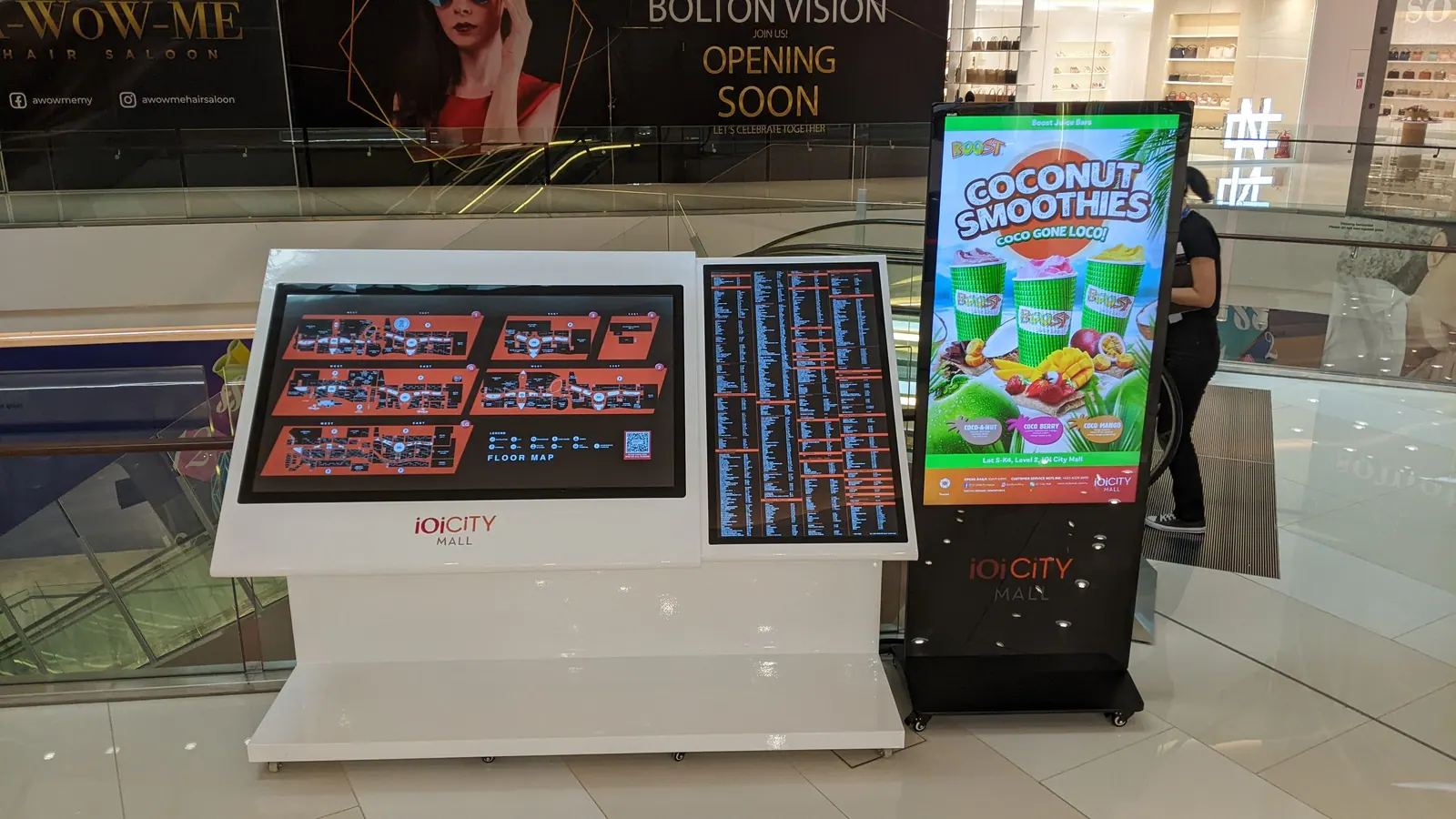
IOI City Mall launched a web-based in-mall digital way finding system, developed by third-party vendor Abuzz Solutions, across selected malls:
The web interface and system infrastructure were handled externally.
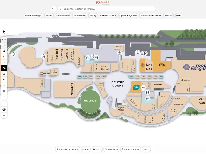
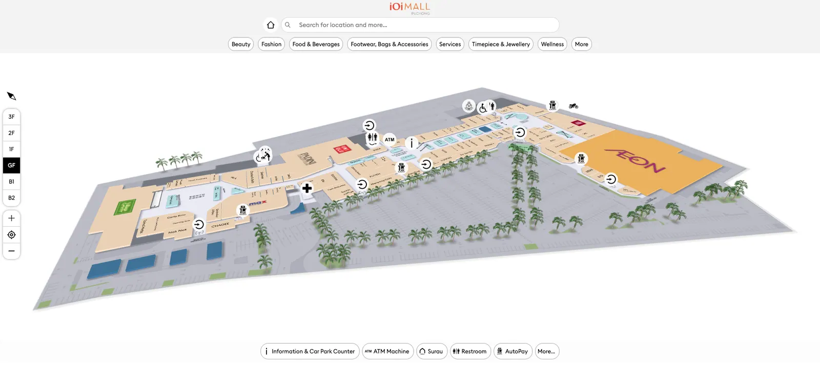
I was tasked to design and construct the illustrated floor maps, which serve as the core navigation layer for the entire system.
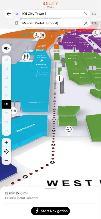
Everything — tenant search, amenities filtering, routing overlays — would sit on top of these maps.
Accuracy and clarity were critical.
Problem
The foundation resource provided was a 1-month validity period of leasing plan in PDF format only. However:
1. Leasing Plan ≠ Reality
The leasing plan:
Updates every month
Reflects commercial status, not physical condition
Does not always reflect ground truth
On the technical issue, I cannot convert the PDF to vector due to a lot of clipping mask within the exported file.
During site reccy, I found:
Missing amenities
Incorrect tenant names
Different zone indicators
Inconsistent parking pillar references
Lift quantities mismatched
Directional inconsistencies
Relying solely on the plan would produce an inaccurate navigation tool.
2. Scale & Complexity
Mall sizes:
ICM (Putrajaya) – ~2.5 million sq ft, 9 floors
IMP (Puchong) – ~1 million sq ft, 6 floors
IMD (Damansara) – ~1 million sq ft, 11 floors
Each mall has:
Different zoning logic
Different amenities distribution
Different circulation layouts
ICM uses quadrant-based zones (A–H).
IMP and IMD do not follow the same zoning system, thus making a single template could not be blindly applied, but they shared the same resources such as assets of icons and components.
3. Navigation-First Constraint
Unlike a printed directory, this was a digital navigation system through functional spatial communication, which require the map need to:
Be legible at multiple zoom levels
Support layered overlays
Remain clean under dynamic UI elements
Avoid visual noise
Strategy
1. Ground Truth First
When I first started for the first mall, I rely 100% on the leasing map. However, due to the false discovery, I refused to depend solely on leasing plans. I conducted full site reconnaissance for each mall:
Walked each floor physically
Cross-checked tenant names
Verified amenities locations
Validated lift cores
Confirmed directional markers (the way finding signages)
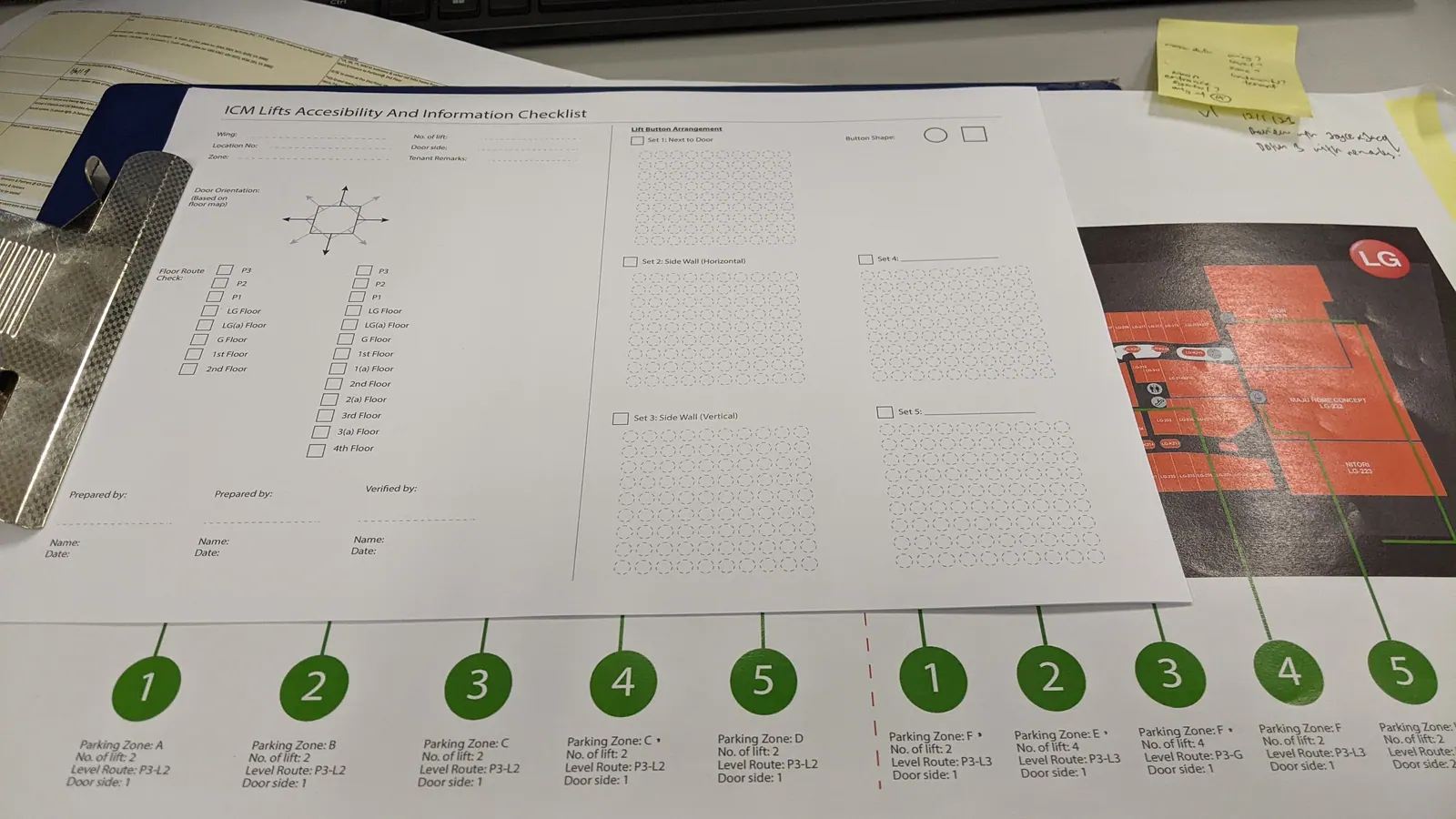
I converted all data into a physical checklist and created my own printed validation template to compare; the Leasing Plan, Actual Ground Condition and Digital Illustration to ensure alignment before digitization.
2. Phased Mall Deployment
The rollout was sequential within the same year and their dedicated time invested throughout the process along the way:
| Mall | Total Days Invested | Site Reccy & Checklist | Map Illustration (Draft to Approval) | Validation | Final Artwork Preparation |
|---|---|---|---|---|---|
| ICM (Putrajaya) | 40 | 3 weeks | 2 weeks | 2 days | 3 days |
| IMP (Puchong) | 12 | 3 days | 1 week | 1 day | 1 day |
| IMD (Damansara) | 16 | 1 week | 1 week | 1 day | 1 day |
Time difference reflected size and spatial complexity.
Each reconnaissance involved thousands of steps and coordination with a Visual Merchandising officer familiar with spatial details.
3. Structured Map Construction Process
For each mall:
Step 1 — Trace Base Structure
Converted leasing plans into clean line versions.
Step 2 — Apply Base Color System
Defined zoning or neutral color logic depending on mall.
Step 3 — Apply Final Visual System
Introduced final color hierarchy for:
Tenants
Circulation
Anchor lots
Amenities
Step 4 — Standardize Iconography
Redesigned and unified amenities icons:
Toilets
Lifts
Escalators
Parking
Services
Special facilities
Step 5 — Point-by-Point Plotting
Every amenity manually plotted and validated.
Step 6 — Final Site Validation
Conducted a second physical walkthrough to ensure:
Digital map = Ground condition
Only then delivered to mall representatives.
Execution
Map System Logic
Designed the maps to:
Remain readable when layered with search results
Allow visual hierarchy for anchor tenants
Avoid over-texturing
Maintain consistency across three malls
Accommodate future updates
Zoning Adaptation
ICM:
Quadrant-based A–H zone logic
Large-scale segmentation required
IMP & IMD:
No explicit zone labeling
Required circulation-based visual clarity
Each mall required tailored spatial logic rather than forced uniformity.
Cross-Department Alignment
After completion:
Shared with each mall’s representative
Coordinated feedback loops
Integrated revisions before final deployment
Ongoing Monitoring
Post-launch responsibilities included:
Updating tenant changes
Adding new lot shapes
Adjusting amenities
Maintaining spatial accuracy
The map is a living system, not a static deliverable.
Outcome
Designed accurate illustrated maps for 3 major malls
Validated through physical site reconnaissance
Standardized icon system across properties
Created scalable mapping framework
Enabled high-volume digital navigation usage
Impact
Reusable illustrated map for location internal reference.
User interaction established in the digital way finding for 2025:
IOI City Mall, Putrajaya (ICM) – 1.8 million interactions p.a
IOI Mall Puchong (IMP) – 150,000 interactions p.a.
IOI Mall Damansara (IMD) – 240,000 interactions p.a.
The illustrated maps became the navigational backbone for millions of user sessions. Internally, colleagues noted:
“Did you come out with your own template? That’s amazing.”
The template-based validation process improved spatial accuracy and reduced post-launch correction risk.
With thanks to Haris, Hanif, Farouq, Eric, Joyce, Lydia, Henry.